(Photo credit: High Country Gardens.)
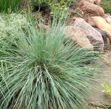
Evergreen. This year we carry F. glauca ‘Boulder Blue’, a 10”-tall selection with very blue foliage, good form, hardiness, longevity and drought-tolerance. We also have F. ovina “Sea Urchin”, smaller, finer texture, good for rock gardens or Asian-style gardens, and Festuca thurberi, which is native from 5,000’ to 10,000’ elevation and is nearly evergreen, to 12” tall.
Hardy to Zone 4.
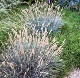
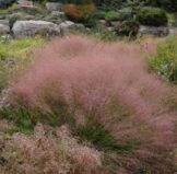
 A much sought-after modest-sized evergreen grass with powder-blue blades, and that has some shade tolerance. It forms an open, symmetrical mound of foliage from 12” to 24” high, and a bit wider, looking like the ‘big brother’ of Blue Fescue. Bloom stalks add another 12 to 18”, and provide interest for several months.
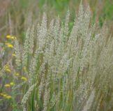
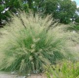
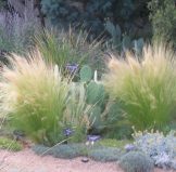 Also known as Ponytail Grass, this small grass, to 14” tall, has very fine-textured blades that make a ‘fountain’ of green. It can sometimes be evergreen. This grass may not be very long-lived, but will replace itself with seedlings, which can be relocated when small.
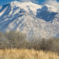 Historically February is one of Colorado’s snowiest months, and finally we’re beginning to see evidence of that this year! Additionally, the forecast indicates more to come. It remains to be seen how some of our marginally hardy garden plants have suffered from the below zero temperatures.
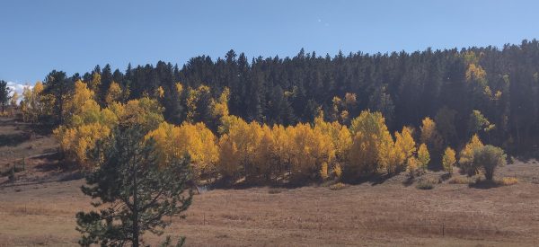
 Our 2022 Fall Members-Only Sale has finished, and now our Big Fall Sale has begun, with 20% off for everyone! Plants included in this week’s sale are:
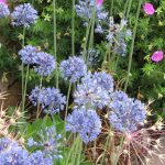 Allium caeruleum (syn. A. azureum) (Blue Globe Onion)
 A most surprising, outrageous flower for xeriscapes! The giant globes, to 10” diameter or more, are held on fairly short stems, 8”-18” tall, blooming in mid-spring. The hundreds of starry, silver-lavender florets each have a green ‘eye’ are arranged so that their petal-tips touch to form a perfect sphere. This easy naturalizer has been highly successful in our xeriscape display gardens, eliciting lots of interest. Also spectacular in large flower arrangements, fresh or dried.
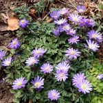 An enchanting, early-blooming member of the Buttercup family that grows from a tuber. Where happy, it spreads to form a carpet-like groundcover with ferny deep green foliage and 1”- wide open-faced sky-blue daisy flowers with yellow eyes. Provides a long-lasting display in early spring.
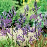
 Waterlily Autumn Crocus
 “The less biodiverse any system is, the greater the potential for its collapse.” Janisse Ray, from The Seed Underground: A Growing Revolution to Save Food.
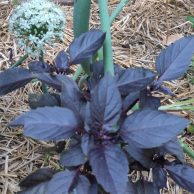 Basil is one of the great culinary pleasures of summer, and it’s definitely NOT TOO LATE to plant Basil and enjoy a good crop! Basil plants are beautiful, grow equally well in the ground or in pots, thrive in hot weather, provide a continuous, bounteous crop, and Basil’s many different flavors are essential to a variety of distinctive cuisines. It can be used fresh, dried, or frozen in oil or as pesto. Though basil leaves lose most of the aromatic oils when dried, we have still found that basil dried from your garden is so much more flavorful than commercial dried basil.
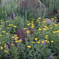 We’re excited that the City of Boulder is gathering feedback from the community about how we use our yards, preferences for landscaping and interest in a citywide effort to create pollinator habitat patches and pathways. Pollinator pathways connect safe, pesticide-free native plant patches of habitat for bees, birds, butterflies, and other wildlife to provide food and nesting sites. Native pollinators are vital to our ecosystems and pathways support pollinator populations, as well as safe passage for movement across the city.
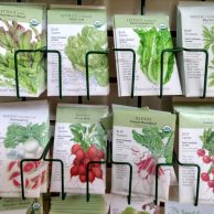
 Yes, you can still plant many vegetables and annual flowers, now at greatly reduced prices! If you are lucky enough to have a greenhouse, you can grow most peppers, eggplants and tomatoes year-round. In the open garden, look for vegetable varieties that mature the fastest – cucumbers and summer squash, tomatoes, and peppers at 75 days or less. And Kale can still be planted in locations with afternoon shade.
 Our best selection of plants for the 2021 season is here now! Our selection of plants for shade and part shade has never been better, including Hosta (many kinds!), Ferns (5 kinds!), Bergenia, Hellebore, Foxglove, Geranium (many), Coral Bells (many), Monkshood, Persicaria, Pulmonaria, Golden Wood Poppy and Clematis (lots!), and some new selections, like Solomon’s Seal (2 kinds)!
 Keep it Covered: Exposed soil is vulnerable to water loss, microbial die-off, erosion and degradation. Use mulch or cover crops to protect it.
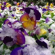 Just as we were beginning to think that Spring was here to stay, a brief return to a winter that never was! It is always wise to prepare for a potential cold snap in the Front Range! According to BoulderCast weather, a strong cold front arrives Friday; a colder Canadian trough with potential for accumulating wet snow at ALL elevations.
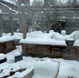 We were just getting comfy and confident in the progressing spring weather, when Mother Nature reminds us that She is in control!
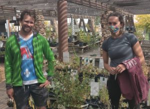
 In mid-August, Mikl and Eve had the pleasure of visiting the beautiful, newly created and planted
  Very tough and xeric, grows 15’ high and wide, white flowers and red berries, loves Colorado conditions!
 25′ xeric tree with golden flowers in July, orange lantern-like pods, orange fall color, seeds abundantly.
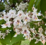 WESTERN CATALPA
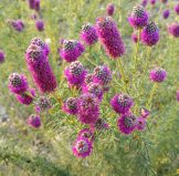
 This includes Amorpha, Manzanitas, Mt. Mahoganies, Big Sage, Fringed Sage, Sand Sage, Lilacs, Butterfly Bushes, Pea Shrubs, Gambel Oak, Viburnums, Spireas, Potentillas, Sand Cherry, Rabbitbrush, Fernbush, Mountain Ninebark, Cliff Rose, Lewis Mockorange, Mikl’s Pick Mockorange, Boulder Raspberry, Boxwoods, Cotoneasters, Honeysuckles, New Mexican Privet, Flowering Quince, Ephedra, Euonymus, Sumacs, Currants, Yuccas, and many more!

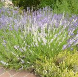 MANY LAVENDERS
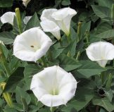
 One of our specialties is
 Do you have plants that you like, but that need to be moved to a different location in your garden? Or has your clump of Shasta Daisy, Daylily, Hardy Geranium, etc. become too wide and now needs to be divided? By dividing your mature perennials, you get free plants to expand your garden, to give to neighbors, or pot up and donate to a fund-raising event like KGNU FM Community Radio’s Spring Plant Sale! The next couple of weeks bring the very best opportunity to accomplish these moves without stressing your plants too much. Search the web for instructions from a trusted source for dividing the specific plant you’re working with.
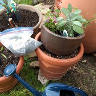 Q: Can I plant now?
 COOL SEASON VEGGIES
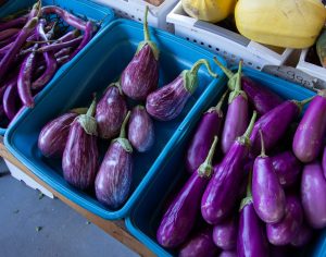 EGGPLANTS
 Even though we are about to receive our biggest snowstorm of this winter thus far, you can still make great progress on your garden by starting seeds indoors or even outside if your garden is prepared and you’re quick and can sow them tomorrow morning! You can also plant our hardy perennials, vines, shrubs and trees that have overwintered outdoors ahead of the storm. And our